

Though it is still possible one or more other systems develop, let’s look at the season with an historical perspective.
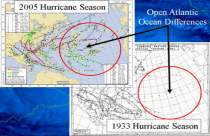
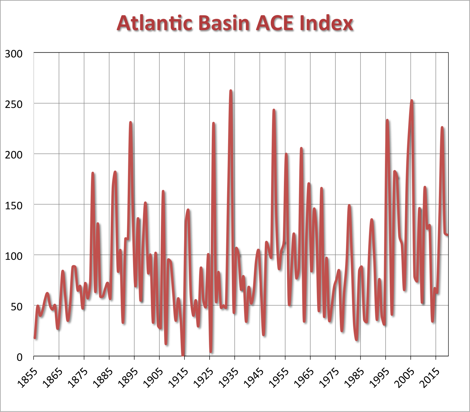
The landfall data is the most reliable data set - before the satellite era, storms may have been missed as illustrated for the top two ACE years 1933 and 2005.
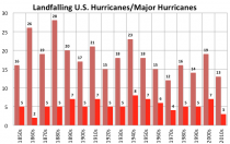
As for intensity, we have seen evidence new technologies may not sync with old w/r to intensity of storms at sea. Still this decade is the second quietest behind the 1860s for major landfalling storms and second quietest for landfalling hurricanes (behind only 1970s).
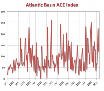
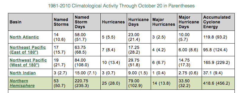
The ACE as of last report was above average due to Dorian and Humberto in the Atlantic, though behind normal in the Pacific and for the Northern Hemisphere.
Total Storms 10-15 (through October 20 we had 14)
Hurricanes: 4-7 (through October 20, we had 5)
Major Hurricanes: 1-3 (through October 20, we had 3)
ACE: 60-110 (through October 20, we had 119.8)
The areas to watch also was mostly on target
_thumb.png)
_thumb.gif)
Joe Bastardi noted in April: “On the high end, if the El Nino isn’t impressive we could see activity in line with last year, hence the relatively broad range.”
See the ACE in the Atlantic, very close to last year
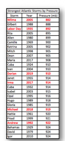
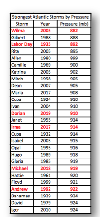
Dorian was the big news item. ranking 13th for lowest central pressure.
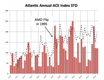
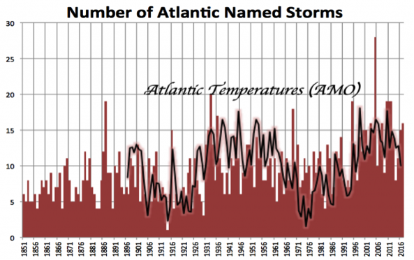
Since the 1970s, you can see the spike after the Atlantic AMO flipped to warm in 1995 as Bill Gray warned.
Though it is still possible one or more other systems develop, let’s look at the season with an historical perspective.
The landfall data is the most reliable data set - before the satellite era, storms may have been missed as illustrated for the top two ACE years 1933 and 2005.
.png)
.gif)